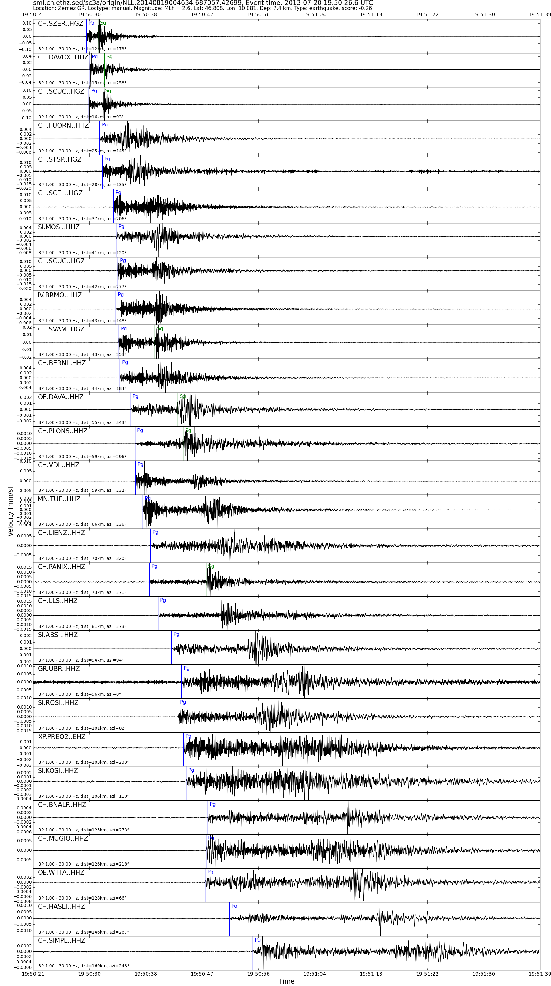
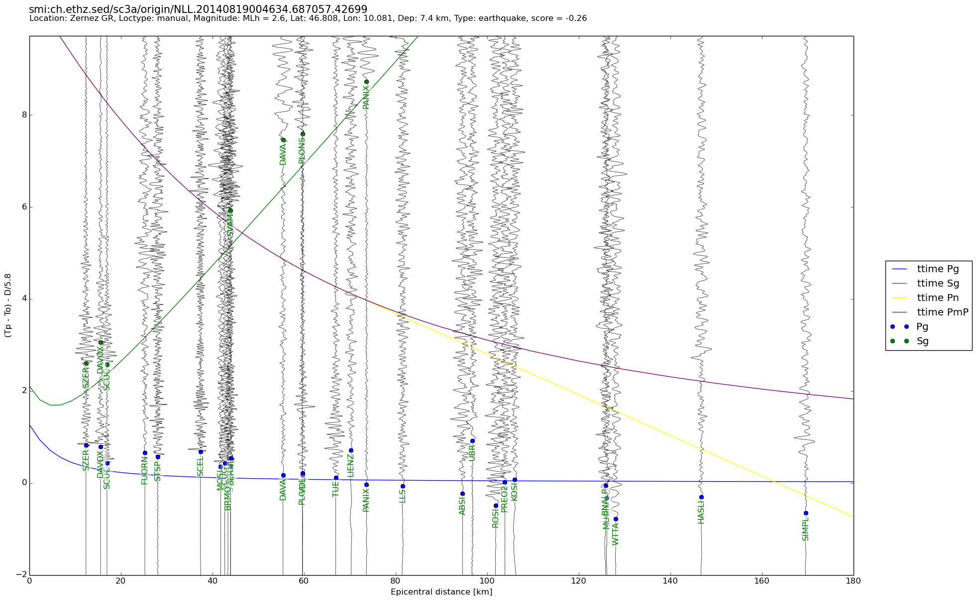
| Local time | 2013-07-20 21:50:26 |
|---|---|
| UTC Time | 2013-07-20 19:50:26 |
| Event Type | earthquake |
| Latitude / Longitude | 46.81 / 10.08 |
| Swiss Coordinates | 801654 / 187537 |
| Magnitude | 2.6 |
| Magnitude Type | MLh |
| Location | Zernez GR |
| Depth [km] | 7.4 |
| Location Type | manual |
| Agency | SED |
| Last Update | 19-08-2014 00:46:38 |
| Danger level | - |
| Origin ID & Metadata | smi:ch.ethz.sed/sc3a/origin/NLL.20140819004634.687057.42699 |